What Are The Biggest States In Nigeria?
In terms of land area, five of Nigeria’s biggest states are Niger, Borno, Taraba, Kaduna, and Bauchi. All the 10 biggest states in Nigeria are located in the Northern region.
In terms of land area, Niger State is the biggest with 76,363km², followed by Borno (70,898km²); Taraba occupies the third position with 54,473 km² while Kaduna and Bauchi are fourth and fifth with 46,053km² and 45,837km² respectively.
For instance, at least 22 of Lagos State land area can be taken out of Niger State (the largest state), yet Lagos is the most populated state in Nigeria.
Takeaway:
- Five out of six states in the North East make the list of the top 10 biggest states in Nigeria. Only Gombe in that region didn’t make the list.
- No state from South-West or South-East and South-South makes the list of top 10 largest states in Nigeria.
- North is larger than the entire South in terms of land area.
- Most of the states with large area size have parts of their land taken over by terrorists or bandits e.g Borno, Zamfara, and Niger
So…
What are the top 10 biggest states in Nigeria using their land area?
Over time, there has been debate over which state is the largest between Niger and Borno State. An argument like this can only be backed by data. Nigeria, the most populated country in Africa covers 923,768 square kilometres or 356,376 square miles.
Nigeria’s landmass extends from the Gulf of Guinea in the south to the Sahel (the shore of the Sahara Desert) in the north. The land area is shared among the 36 states.
In terms of land area, here is the list of biggest state in Nigeria:
1) Niger State
- Land area: 76,363km²
- Geopolitical zone: North Central
- Date of creation: February 3, 1976
Covering 76,363km², Niger State is the biggest state in Nigeria. Apart from sharing borders with other states, Niger’s land area extends to the Republic of Benin, making it one of the states in Nigeria that share international borders with African countries.
It was one of the states that were created the military regime of Gen. Murtala Muhammed on February 3, 1976. Alongside Sokoto, it was carved out of the old North-Western State.
With 25 local government areas in Nigeria, major towns in Niger state are Minna (the state capital), the popular Shiroro, Katcha, Kontagora, Bida, Lapai, Suleja and Zungeru among others.
2) Borno State
- Land area: 70,898km²
- Geo-political zone: North East
- Date of creation: February 3, 1976
The second-largest state in Nigeria is Borno State, covering 70,898km² land area. The state houses Sambisa Forest, a hideout for Boko Haram members.
The forest is said to be larger than Lagos State and a few other states in the Southern region.
It was part of the North-Eastern State before Murtala Muhammed created states in 1976. Borno’s land area extends to three African countries: Republic Chad, Republic of Niger, and Cameroon, sharing the highest land borders with other countries.
Until the activities of Boko Haram and ISWAP plunged the state to be among the most dangerous states to live in Nigeria, Borno State used to be one of the most peaceful states, earning it the “Home of Peace“.
With 27 local government areas, Borno’s major towns are Maiduguri (the state capital), Biu, Damboa, Chibok (where school children were kidnapped by Boko Haram), and Konduga among others.
3) Taraba State
- Land size: 54,473 km²
- Geo-political zone: North East
- Date of creation: August 27, 1991
Created out of the old Gongola State on August 27, 1991, by the military regime of General Ibrahim Babangida, Taraba State is the third-largest state in Nigeria, covering 54,473km² land area.
It isn’t just large, it houses most of the tourist attraction locations in Nigeria. It is famous for its Mambilla Plateau and several national parks
There are 16 local government areas in Taraba with major towns that include: Bali, Gashaka, Kurmi, Jalingo (the state capital), Sardauna and Wukari among others.
4) Kaduna State
- Land area: 46,053km²
- Geo-political zone: North Central
- Date of creation: May 27, 1976
Kaduna is one of the earliest states that were created by the military regime of Gen Yakubu Gowon from the old regions. It covers a land area is 46,053km²
Apart from the 4th largest state in Nigeria, Kaduna has many political histories. One, as the base for the first British governor of Northern Nigeria, Sir Frederick Lugard.
Two, as the headquarters of the Northern region before Nigeria, gained independence.
5) Bauchi State
- Land area: 45,837km²
- Geo-political zone: North East
- Date of creation: February 3, 1976
Created on February 3, 1976, Bauchi State covers 45,837km² of land area, making it the top five biggest states in the North and in Nigeria.
With 20 local government areas, the state’s major towns include Bauchi (the state capital), Giade, Toro, Bununu, Kirfi, and Dass among others.
6) Yobe State
- Land area: 45,502 km²
- Geo-political zone: North East
- Date of creation: August 27, 1991
Covering 45,502 km² land area, Yobe state is 6th out largest state in Nigeria. It was carved out of the old Borno State by the military regime of Gen Ibrahim Babangida.
With 17 local government areas, major towns in Yobe include: Damataru (the state capital), Gulani, Fika, Geidam, and Bade among others.
7) Zamfara State
- Land area: 39,762km²
- Geo-political zone: North West
Until October 1, 1996, when it was created by Sani Abacha, Zamfara was part of Sokoto State.
Dramatically, Zamfara is larger than Sokoto. It covers 39,762km² land area, making it the 7th on the list of biggest states in Nigeria
It has 14 local government areas with major towns in as Gusau (state capital), Zugu, Anka, Kaura-Namoda, and Talata-Marafa among others.
Zamfara is the home to the most dangerous bandits and remnants of terrorists. The fairly secured town in the state is its capital Gusau.
8) Adamawa State
- Land area: 36,917km²
- Geo-political zone: North East
- Date of creation: August 27, 1991
With 21 local council areas, Adamawa covers 36,917km² of land area, making it 8th on the table. It also shares borders with Cameroon.
Major towns in Adamawa include Yola (state capital), Michika, Gombi, Mubi, Jimeta, and Guyuk among others.
9) Kwara State
- Land area: 36,825km²
- Geo-political zone: North Central
- Date of creation: May 27, 1967
As one of the earliest states in Nigeria, Kwara was created on May 27, 1967, with its capital in Ilorin. Major towns include Ilorin (state capital), Omu Aran, Offa, Patigi among others.
10) Kebbi State
- Land area: 36,800km²
- Geo-political: North West
- Date of creation: August 27, 1991
And finally, Kebbi State is the 10th largest state in Nigeria, covering a land area of 36,800km²
With its capital in Birnin Kebbi, it is home to Nigeria’s fishing festival Argungu. It has 21 local council areas.
It shares borders with the Niger Republic and the Benin Republic. Locally, it shares boundaries with Sokoto, Zamfara and Niger state
Is Lagos State the largest state in Nigeria?
What is the biggest and smallest state in Nigeria?
Is Kaduna bigger than Kano?
However, Kano is bigger than Kaduna in terms of population
How big is Sambisa forest in Borno State?
There are debates over the specific size of the deadly forest which is now hideout of Boko Haram, but Dr. Ezekwesili revealed that the forest is 60,000 square kilometres, “Eighteen times the size of Lagos State! All of Lagos is 3,345 square km,” she tweeted in 2017
On January 17, 2017, she went on a tour of Sambisa with the Nigerian Airforce (NAF).
Recap:
The ranking of Nigerian States by land area, the top largest are captured in the table below:
| Largest Nigerian States | Land Size by km² | Position |
| Niger | 76,363 | 1 |
| Borno | 70,898 | 2 |
| Taraba | 54,473 | 3 |
| Kaduna | 46,053 | 4 |
| Bauchi | 45,837 | 5 |
| Yobe | 45,502 | 6 |
| Zamfara | 39,762 | 7 |
| Adamawa | 36,917 | 8 |
| Kwara | 36,825 | 9 |
| Kebbi | 36,800 | 10 |
Sources
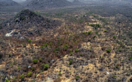
- Featured Image by Daily Trust
- Olaniyan Azeez (2018). “Once Upon a Game Reserve: Sambisa and the Tragedy of a Forested Landscape”. Environmentandsociety.org. Retrieved March 6, 2022
- Romoke Ahmad (October 1, 2021). “Boko Haram rules 500 communities in Niger, says Shiroro LGA chairman”. Punchng.com. Retrieved March 7, 2022